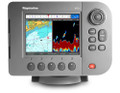
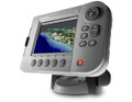
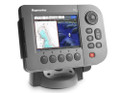
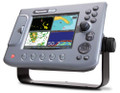
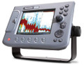
Raymarine C120Features
|
Multifunction
- Configure any C-Series display as single function stand-alone chartplotter,digital fishfinder or radar.
- Build a powerful all-in-one chart/radar/sounder system.
- SIRIUS Satellite Weather and Radio integration.
|
|
Intuitive
- The intuitive C-Series interface puts you in command. Simply “Page”through your choice of displays
- Create custom windows of any combination of chartplotter,radar or sonar.
- Twist N’ Click™ Rotary control provides easy alphanumeric waypoint storage.
|
|
Advanced Display Technology
- Direct Sunlight Viewable
- High resolution 256 color displays
- Excellent contrast and a wide viewing angle
- Very low profile flush mounting for a clean, unobtrusive helm.
- Rugged and weatherproof (CFR46)
|
| C120 Weather and Satellite Radio |
|
simply add the new Raymarine SR50 weather receiver for access to the latest graphical weather forecasts and SIRIUS satellite radio.
|
- Animated WSI NowRad® weather radar, storm track cell tracking and lightning strike reports.
- Up-to-date Satellite Sea Surface Temperature observations give fishermen a tactical advantage.
- Animated surface pressure, wind forecasts, wave heights and more.
- Context-sensitive cursor reveals weather data at any location with the click of a button.
- Marine watch box warnings alert you when severe weather advisories are issued for your area
- 130 channels of commercial free music, news, sports, talk and more.
- Convenient radio tuner controls right from your C-Series display.
- High-quality audio output to your boats stereo receiver auxiliary input or amplifier.
|
| C120 GPS Chartplotter |
|
Connect an optional Raystar GPS Sensor and choose Navionics charts to transform any C-Series display into accurate and detailed GPS charting system.
|
- Support for professional quality Navionics® vector charts on CompactFlash.
- Fast chart screen redraw.
- 256 color high resolution display provides paper-like chart clarity
- True or relative motion and course-up/north-up/head-up modes.
- Auto Range mode intelligently maintains your vessel and your waypoint on the best chart scale while underway.
- Loran TD positioning mode
- On screen VHF DSC position reports (when connected to compatible DSC VHF via NMEA,)
- AIS Target tracking using the optional Raymarine AIS250 receiver.
|
| |
| C120 Digital Fishfinder |
|
Transform a C-Series display into the ultimate fishfinder with HD Digital ™ technology using an optional Raymarine Digital Sounder Module .
|
- Raymarine’s patented HD Digital fishfinder technology using a remotely
mounted Digital Sounder Module.
- Hands-free HD Digital technology automatically adjusts more than 220 sonar parameters per second and virtually eliminates clutter.
- HD Digital adaptive receiver technology targets fish and bottom structure
with amazing clarity.
- 600 or 1000 Watt power output with dual frequency 200/50 Khz operation.
- Bottom lock, A-Scope and zoom modes.
- Maximum depth of 5000 ft. (1700 meters.)
- Full range of high and ultra high performance transducers available.
|
| C120 Radar |
|
Raymarine brings you unmatched radar performance. Connect an optional radome or open-array antenna to any C-Series display to create a powerful radar system.
|
- Radar/chart overlay.
- MARPA (Mini-Automatic-Radar-Plotting-Aid) target tracking.
- Waypoint navigation and multiple waypoint overlay.
- Low receiver noise figure (less than 5 dB).
- Auto GST™ fully automatic gain,sea clutter and tune control for real hands off operation.
- Advanced microprocessor controlled transmitter-receiver features 8 pulse width/PRF settings, providing enhanced target returns through every range scale.
- AIS Target tracking using the optional Raymarine AIS250.
|
|
C120 Engine and Instrument Data Integration
|
|
With support for SeaTalk, SeaTalk NG (next generation), NMEA 0183, NMEA 2000 and J1939, Raymarine C-Series in the center point for all of your vessel's navigation, instrument, and engine data.
|
- Control your Raymarine SeaTalk compatible autopilot right from your C-Series display.
- Repeat information from your connected instruments, autopilot, GPS, weather instruments and more.
- Customizable data displays support multiple combinations of graphical, digital and analog information.
- Monitor critical engine functions like RPM, oil pressure, fuel level and flow rate, coolant temperature, trim tabs and engine tilt, generator electrical data and more using NMEA2000 or J1939.
|
Raymarine C120 Specifications
| General |
| |
Data Display Capabilities |
Chartplotter, Fishfinder, Radar, Satellite Weather, CDI(Course Deviation Indicator), and customizable Data Bar display |
|
| |
Dimensions |
357 x 267 x 110mm |
|
| |
Display (LCD) size |
12.1" |
|
| |
Display colors |
256 Colors |
|
| |
Display resolution |
800 x 600 pixels (SVGA) |
|
| |
Display type |
Sunlight viewable color TFT LCD |
|
| |
Mounting Methods |
Bracket or console Mounting hardware included |
|
| |
Operating and non operating temperature limits |
-4°F to 122°F (-10°C to 50°C) |
|
| |
Power consumption |
12 Watts |
|
| |
Voltage range |
10.7–32 volts (12/24v nominal) |
|
| |
Waterproofing |
CFR46/IPX6 standards |
|
| |
Weight |
6.6 lbs (3.0kg) |
|
| |
Approvals CE - conforms to FCC - compliant with |
Essential requirements of 1995/5/EC, 1989/336/EC. CFR47 Parts 2 & 80 |
|
| |
Mounting |
Either trunnion bracket or flush mount option |
|
| |
Humidity limit |
up to 95% at 35°C non-condensing |
|
| |
Display Windows |
Chart, Radar, Fishfinder, CDI, Data, Weather and Engine Monitor. |
|
| |
Illumination |
Screen and keypad: 0 to 100% in 64 steps Day/Night Mode |
|
| |
Languages |
The selection available will vary according to your location. |
|
| |
System Alarms |
Alarm clock, Anchor, Arrival, Deep depth, MOB, Offtrack, Shallow depth, Temperature, Timer |
|
| |
Navigation Alarms |
Arrival alarm, offtrack XTE alarm. |
|
| Interfaces |
| |
NMEA 0183 Input |
GLL, GGA, GLC, GTD, VTG, BWC, BWR, RMA, RMB, RMC, XTE, VHW, HDG, HDM, HDT, DBT, DPT, APB, VLW, MWV, WPL, RTE, DSC and ZDA. Selectable to 4800, 4800 Navtex, 9600 Navtex or 38,400 AIS |
|
| |
NMEA Output - User selectable |
APB, BWC, BWR, DBT, DPT, GGA, GLL, MTW, RMA, RMB, RMC, RSD, TTM, VLW, VHW, VTG, WPL, VHF/DSC and ZDA |
|
| |
SeaTalk Input |
Depth,SOG,COG, Position, Waypoint number, range/ bearing, TTG, Boat speed, Time, XTE, Heading, Wind, data, Log/Trip, Pilot status, Temperature, MOB and cursor position |
|
| |
SeaTalk Output |
Cursor data, guard zone and navigational data bridged from NMEA |
|
| |
SeaTalk2/NMEA2000 |
1 port |
Also supports SeaTalkng (Next Generation data bus) connectivity. Adapter cables required for SeaTalkng and NMEA2000 |
| Chartplotter |
| |
Waypoints |
1000 waypoints entered via cursor, lat/lon, range and bearing from present position or at boat’s position. 16 character name can be assigned. Waypoint symbols and groups Additional storage available on CompactFlash cards. |
|
| |
Waypoint Transfer |
Waypoints database via NMEA and CompactFlash cards. Software also available to convert waypoints to Excel file. |
|
| |
Man Overboard (MOB Mode) |
Mark placed with course line; readout shows range, bearing, lat/lon of MOB and time elapsed since MOB. |
|
| |
Screen functions |
Full, half and quarter screens available dependant on function. Also 3 window page with 2 x 1/4 page windows and 1 x 1/2 page window. |
|
| |
Cartography |
Navionics Charts on CompactFlash cards Chart of the world built in. |
|
| |
Chart scaling |
1/32nm (if cartographic detail is available to 4000nm). |
|
| |
Presentation Modes |
Head up, Course up or North up (selectable True or Mag-netic). Relative, Autorange or True Motion. Screen offset. Radar or 3D synchronization. |
|
| |
Routes |
A route plan may contain up to 50 waypoints. Up to100 routes can be stored in the units internal memory. Additional storage available on CompactFlash cards. SmartRoute to create a route from track history. |
|
| |
Track History |
10 tracks with up to 1000 points in each can be stored in the units internal memory. Track optimization reduces number of points used or user selectable time or distance interval. Additional storage available on CompactFlash cards |
|
| |
Radar/Chart overlay |
Radar image can be overlaid on all screen charts. |
|
| |
Radar/Chart synchronization |
To synchronize radar range and chart scale |
|
| |
AIS overlay |
Switch AIS symbols on/off. Display heading/speed vectors and ROT. View detailed AIS data, safety critical target data, ALR and SRM messages. Set up a safe zone. |
|
| |
Navigation information |
Own boats position in lat/lon, XTE, TTG and SOG/COG selectable. Bearing and distance to waypoint. Bearing and distance to cursor and ETA. |
|
| |
Cartography |
Navionics Charts on CompactFlash cards Chart of the world built in. |
|
| Radar |
| |
Range Scales (Range Rings) |
1/8 (1/16)nm to 72 (12) nm dependant on scanner Performance limited by scanner type and position. |
|
| |
Range Ring Accuracy |
Better than +/- 1.5% of the max. range scale in use, or 22m (72 ft.), whichever is the greatest. |
|
| |
Bearing accuracy |
+/- 1° |
|
| |
Variable Range Markers |
2 x VRM’s, readout nm, sm, km |
|
| |
Electronic Bearing Lines |
2 x EBL’s, floating if required, resolution 1° |
|
| |
Bearing scale |
360° graduated at 10° intervals 2° small ticks 10° large ticks |
|
| |
Minimum range |
23m (25 yds) |
|
| |
Range Discrimination |
23m (25 yds) |
|
| |
Presentation Modes |
Head up, Course up or North up (selectable True or Mag-netic) Relative or True Motion |
|
| |
Scanner Control |
Interference rejection, standby/transmit modes, pulse selection, Tune, Rain, FTC and Sea controls, with selection of manual or automatic control of gain, sea clutter and tune (Auto GST) |
|
| |
Compass Input |
NMEA 0183 (required for fast heading data, suitable for MARPA), or SeaTalk |
|
| |
Waypoint Display |
Create waypoints and target waypoint displayed with User control of symbols and groups |
|
| |
MARPA |
Manual acquisition of 10 targets, automatic tracking, dangerous target alarms, safe zone, target history, true or rela-tive vectors, CPA graphics and indication of target speed/ course, bearing/ range, CPA and TCPA. |
|
| |
Guard Zone Alarm |
2 guard zones, selectable sensitivity level, audible alarm |
|
| |
Automatic Tuning |
Auto control of gain, sea clutter and tune. |
|
| |
Off Center function |
In Relative Motion, 1/3 or |
|
| |
Wakes |
10s, 30s, 1 min, 5 min, 10 min, OFF |
|
| |
Target Expansion |
Operator selectable with 2 levels available, OFF |
|
| |
Timed TX |
Rotation periods: 10, 20 or 30 scans Repetition periods: 3, 5, 10 or 15 minutes |
|
| |
AIS overlay |
Switch AIS symbols on/off. Display heading/speed vectors and ROT. View detailed AIS data, safety critical target data, ALR and SRM messages. Set up a safe zone. |
|
| Fishfinder |
| |
Transducer |
Transom-mount, in-hull or thru-hull options |
|
| |
Receiver Type |
Patented Raymarine HD Digital receiver technology |
|
| |
Power output |
Dependant on Digital Sounder Module |
|
| |
Frequency |
Dependant on Digital Sounder Module |
|
| |
Alarms |
Fish alarm, fish alarm depth, shallow and deep fish limit |
|
| |
A-Scope Display |
Displays Sonar Returns in real time |
|
| |
Bottom Coverage Display |
Shows the diameter of the transducer beam where it meets the bottom. |
|
| |
Bottom Lock |
Displays echoes directly above the bottom. |
|
| |
Range markers |
Easily see how far the boat is from a target on the echo sounder screen |
|
| |
Target Detection |
Sonar fish echo with target depth readout |
|
| |
Zoom |
2,3,4x and user programmable Zoom scales |
|
| Instrument and Engine Data |
| |
Data Pages |
5 pages available. Pre-defined (Navigation, Waypoint, Route, Fishing or Sailing) or user-configured. |
|
| |
Data available |
Vessel position, active waypoint, TTG, VMG - Waypoint, depth, COG SOG, heading, speed, set/drift, trip, log, ground log, ground trip, rudder, local time and date, sea temperature, app wind, true wind, VMG wind, ground wind XTE,compass,locked heading, way |
|
| |
Engine Pages |
5 pages available. Pre-defined (engine, engine and fuel, fuel resources, engine and resources, twin engines or triple engine support) or user-configured. |
|
| |
Engine Data available |
Tacho, boost pressure, alternator, oil pressure, coolant temperature, engine hours, fuel level (tanks 1 & 2), fuel rate, total fuel, load. |
|
| Weather |
| |
Type |
SIRIUS Marine Weather |
|
| |
Weather elements |
Storm cast, waves, Canadian radar, lightning, wind, sea sur-face temperature, surface observations stations, city weather, NOWRad, storm tracks, surface pressure. |
|
| |
Animated weather graphics |
Weather forecast, weather radar history |
|
| |
Weather reports |
Tropical statements, marine warnings, marine zone fore-casts, marine watchbox. |
|
| NavTex |
| |
Alerts |
Incoming message (selectable categories) |
|
| |
Message List |
Sorting |
|
| AIS |
| |
Target symbols |
Sleeping, activated, selected, dangerous and lost. |
|
| |
Target information |
AIS vectors, safety critical data and full AIS data. |
|
| |
Collision avoidance |
Safe zones and safety messages. |
|
| |
Alarms |
Local alarm messages, lost targets |
|
| Satellite Radio |
| |
SIRIUS Satellite Radio |
When connected to optional SR50 SIRIUS Satellite Radio and Weather Receiver. Subscription required, sold seperately. |
|
 Loading... Please wait...
 New Products
 $726.45
 $713.16
 $497.10
 $774.34
 $1,277.94

)